We invite Emergency Planners to join a co-creation workshop exploring emergency routing and incident response through RouteMAIT.
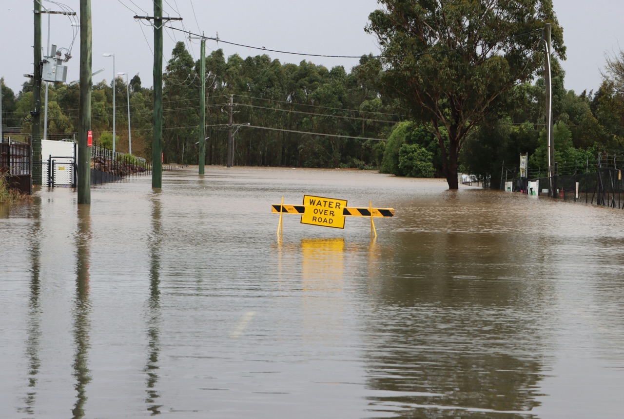
Anyone involved in emergency planning and incident response are invited to join the SIREN UK Consortium for an in-person co-creation workshop at the University of Leeds, exploring how shared, real-time incident data can support safer, faster emergency response. A crisis such as a flood doesn’t just leave water — it leaves hazardous debris that blocks bridges and culverts, slows or closes roads, strains crews, and undermines public confidence as “almost open” routes change hour by hour.
About the SIREN RouteMAIT Initiative
The (ITEA sponsored and Innovate UK funded) SIREN UK Consortium proposes to develop a MAIT-based (Multi-Agency Incident Transfer protocol) routing tool, RouteMAIT, that gives emergency responders a live picture of debris hazards and road states. RouteMAIT responds to MAIT messages with adaptive routes that fuse models and sensor evidence to incorporate real-time constraints.
The payoff for emergency planners and incident responders is faster, safer reopening of priority corridors, fewer crossed wires between agencies, better evidence for debriefs and claims, and a practical cadence (e.g. sub-5-minute single-crew updates, ≤15-minute sector sweeps) that restores access and confidence sooner.
Professionals working in emergency planing and blue light incident response are invited to attend an in-person workshop hosted at the University of Leeds on 27 February 2026, to begin co-creation of this tool with the SIREN UK Consortium and to discuss options for pilot deployment.

Who Should Attend
The workshop is intended for anyone involved in emergency planning, incident response, highways, transport operations, flood recovery and multi-agency coordination in particular members of the Emergency Planning Society.
Event Details
Date: 27 February 2026 | Location: University of Leeds | Cloth Hall Court
Format: In-person workshop, online attendance available
Workshop Context
Why it matters for operations and routing
- Blockages: culverts and bridges clog, leading to road closures and increased upstream flooding.
- Road safety: sharp objects, mud and stranded vehicles result in “slow” or “closed” states.
- Follow-on hazards: contaminated debris requires PPE and specialist disposal routes.
- Logistics: clearance must be co-planned with waste sites and vehicle constraints (e.g. weight limits, water depth).
Flooding commonly generates significant debris
- Vegetation: trees, branches and reeds torn out by fast flow.
- Built-environment fragments: road surfacing, masonry, roofing, fences, signage and street furniture.
- Vehicles and appliances: cars, skips, bins, oil tanks and sheds.
- Sediment and drift: silt, gravel, cobbles and plastics.
- Hazardous materials (spotty): fuel, pesticides and sewage-contaminated waste.
SIREN models debris as a dynamic constraint
- Compute time-varying impact layers (flood depth / speed → road state) to derive route states (open / slow / closed / damaged) with validity time windows for the region enclosing the incident — based on confidence and certainty of input data, risk tolerance, and human-in-the-loop local managerial logic.
- Assign confidence levels to predicted route states, if possible at T+1, T+10, etc.
- Identify adjacent or secondary hazards and risks, such as those caused by water contamination.
How floods create debris
- Hydrodynamic force and scour detach and transport objects.
- Undermining of banks, foundations, culverts and bridge abutments causes structural break-up.
- Backflow and overland flow lift loose items (e.g. waste bins, garden objects) into carriageways and culverts.
Workshop Aims
RouteMAIT aims to turbo-charge post-crisis resource allocation
MAIT provides a common, real-time incident stream across police, fire, ambulance and local authority control rooms. By treating debris hazards, closures and clearance tasks as MAIT incidents, RouteMAIT can coordinate multi-agency crews, keep maps in sync, and continuously re-plan as conditions change.
Minimal data required
- MAIT feed (hub or point-to-point)
- AddressBase (UPRN / USRN)
- OS road base
- Flood depth and speed rasters (good-enough resolution)
- Tip sites and waste streams
- Vehicle and plant profiles
- MCP connectors (CCTV, traffic and sensors)
- JOSM authorisation mechanisms
Edge cases handled
- Re-blockage risk: add penalties to links with high floating-debris probability.
- Partial openings: encode lane-level states with speed penalties rather than hard closures.
- Uncertain geometry: push verification tasks and keep conservative defaults until confirmed.
Realistic Service-Level Objectives (SLOs) to aim for
- <5 minutes to issue or update a single-crew route after a new MAIT incident.
- ≤15 minutes to produce an initial multi-crew sector sweep.
- Rolling 30–60 minute re-plans while flood dynamics persist, with ≤60 second re-optimisations for urgent updates.
Register Your Interest
Places are limited to support meaningful discussion and co-creation.
We invite you to register your interest to help us plan attendance and share joining instructions closer to the even